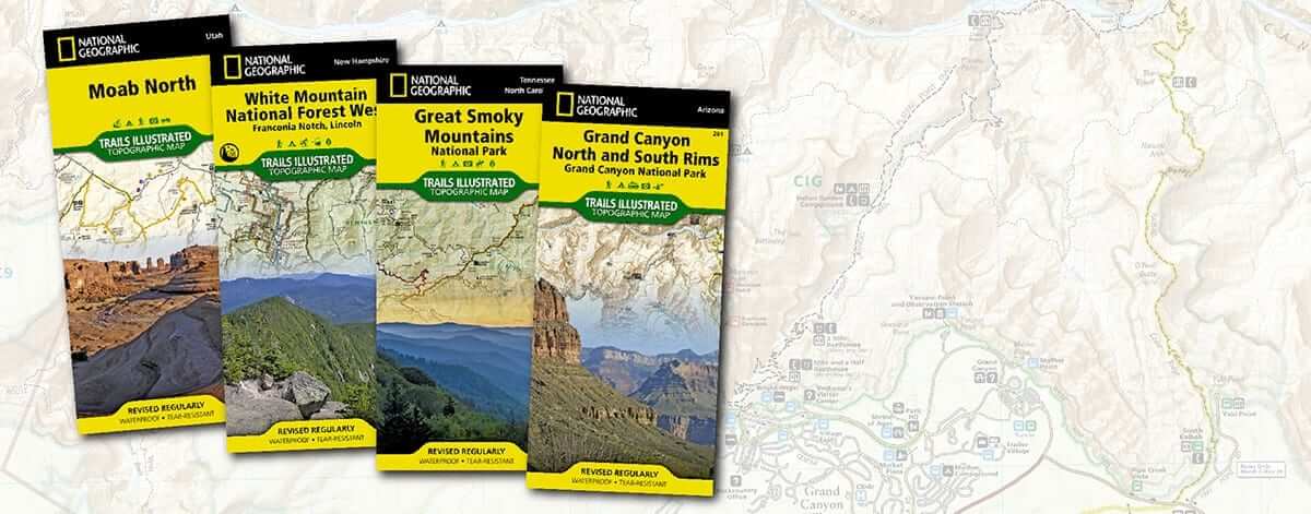
Purchase your own NatGeo maps online!
Photo Credit: National Geographic
Are you planning your spring and summer hikes? Instead of trekking the same landscape as last year, the team at Appalachian Outfitters encourages you to explore new trails with Trails Illustrated maps from National Geographic. Reach new heights and see breathtaking views with these maps in your pocket! National Geographic’s
Trails Illustrated maps include over 250 trails. With over 20 years of research and experience, these are the maps to trust. NatGeo maps are famous for accuracy, as illustrators meet with local land managers to create the maps, resulting in clear trails, precise topography, navigation cues, and recreational sites. Only after serious review and editing are the maps released to the public. As an added bonus, each map is printed on tear-resistant, waterproof paper to withstand any elements you face on the trail. Because 250 maps can be overwhelming, we’ve gathered information about our top eight favorite National Parks hiking trails from East to West.
Endless Wall Trail at New River Gorge National River
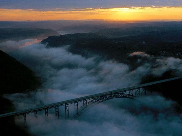
See this beauty up close when you hike Endless Wall Trail.
Photo Credit: West Virginia's New River Gorge Bridge was the world's longest steel-arch bridge (Shanghai's Lupu Bridge took the title in 2003). It opens to pedestrians once each year on "Bridge Day." -Photograph by Susie Post Rust
Distance: 2.4 miles Difficulty: Moderate Trek this trail to cross Fern Creek and stand on a cliff above the New River. Diamond Point is an added highlight, with its magnificent overlook of the cliffs and surrounding scenery. This trail displays all the natural beauty of West Virginia’s dramatic landscape.
Cadillac Mountain at Acadia National Park
Distance: 4.4 miles Difficulty: Moderate to difficult Cadillac Mountain is best known for watching the sunrise at the top of the 1,528-foot peak. This mountain is the highest in the park, giving it a perfect view of Frenchman Bay and Bar Harbor. It’s well worth the hike up the bare rock to experience the sunrise view.
Highline Trail at Glacier National Park

Climb Highline Trail to see the sites at Glacier National Park.
Photo Credit: National Geographic
Distance: 15.2 miles Difficulty: Difficult Glacier National Park is known for its breathtaking views, and Highline Trail is no exception. This popular hike follows the Garden Wall ridge on the continental divide. The trail is home to Granite Park Chalet, where hikes can spend the night before continuing their adventure.
Hoh River Trail at Olympic National Park
Distance: 17.4 miles Difficulty: Easy to moderate During this hike, you see a montane forest, a subalpine meadow, and a temperate, moss-draped rain forest. From the trailhead, you can climb the maintained trail all the way to Glacier Meadows. The switchbacks follow a river, and the vibrant green of Hoh Rainforest is more than worthwhile.
Upper Geyser Basin at Yellowstone National Park
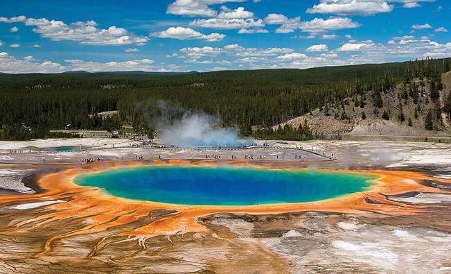
Explore Upper Geyser Basin and see beyond Old Faithful.
Photo Credit: National Geographic
Distance: Varies Difficulty: Varies Yellowstone National Park is best known for Old Faithful, but after you see the famous geyser, we recommend seeing Upper Geyser Basin. About 60% of earth’s geysers are found inside one mile in the basin. Multiple trails take hikers on a journey close to five big geysers, countless hot springs, multiple smaller geysers, and a new mudpot.
Ramsey Cascades at Great Smoky Mountains National Park
Distance: 8 miles Difficulty: Strenuous Ramsey Cascades is the tallest waterfall within the Great Smoky Mountains National Park. The water crashes down 100 feet, tumbling over rocks and into a pool at the bottom. See the waterfall and two miles of hardwood forest while you climb 2,000 feet beside streams and rivers.
Angels Landing at Zion National Park
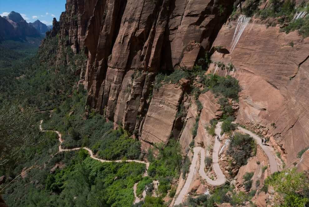
Have a new adventure at Angels Landing.
Photo Credit: National Geographic - Photograph by Andre Distel, My Shot
Distance: 5 miles Difficulty: Difficult Angels Landing takes hikers throughout Zion National Park on switchbacks called Walter’s Wiggles before opening onto incredible Zion Canyon views. Stand on top of a rock formation that stands 1,488 feet over Zion Canyon, and be sure to take plenty of pictures!
Bright Angel Trail at Grand Canyon National Park
Distance: 20 miles Difficulty: Very difficult This trail journeys from the rim of the Grand Canyon to the river at the bottom of the canyon. You can trek using the same path there and back again, but many people take Bright Angel to the bottom of the canyon and then hike South Kaibab Trail back to the rim. To split up the trek, stop at one of the campgrounds along the trail.
A Few Other AO Favorites
Some of our other favorite hikes are in Yosemite National Park, Arches National Park, Shenandoah National Park, Rocky Mountain National Park, and more. Visit an
Appalachian Outfitters location to see our variety of National Geographic Illustrated maps and choose yours for planning your spring and summer hikes! While you’re here, pick up the gear you’ll need for exploring new heights.


